904.504.5744
|
904.504.5744
|
About geoMobiliti
|
|
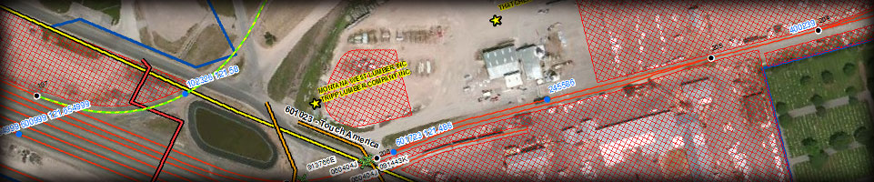
Finding answers that raise the bottom line.We offer a unique bifocal view when developing a GIS and providing real property management services. We focus on the details while not losing sight of the long-term goals. By concentrating on the railroad industry, we understand the railroad business model and industry needs. By integrating databases, spreadsheets and personal files into one portal, the GIS, we have developed a proven system to streamline the application process of new agreements, manage existing agreements, and display all assets on the railroad corridor. Even though we are hired as consultants, we become your partner and work hard in developing a solution that will expose and eliminate redundant efforts, modernize work flows, reduce operating costs and ultimately increase revenue. LOCATION, LOCATION, LOCATION…GIS is all about the location. Working with railroad real estate departments, we have found that in many cases the managers do not know the extent of the assets and facilities on the corridors for which they are responsible. We help by locating those assets. In plain terms, we provide a way for them to see their areas of responsibilities with the convenience of a few mouse clicks. We do our best to provide straightforward answers to complicated questions. Our railroad GIS experience and technical expertise allows us to offer a number of services including GIS consulting, real estate services, database design and implementation, data warehousing, and application development. We also perform field audits to identify unlicensed encroachments and locate all assets on the railroad Right-of-Way. Additionally we offer maintenance and support services after the initial project is completed. |
Areas of Expertise |